3 Oceans Redux: The Story in Photos
Rider and author revisits unseen images from his cross-Canada journey
The 3 Oceans, One Promise feature story was published in the annual edition of The Enthusiast® and was distributed to HOG Canada® members and Harley-Davidson® dealerships across Canada in October 2025. The story chronicled an epic cross-Canada journey that connected three generations and honoured a promise through the power of the open road.
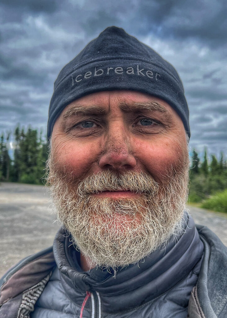
Now, author and rider Mark Keating has returned to hundreds of previously unseen images from the trip — revisiting the cutting-room floor — to present this photo story.
The original story in The Enthusiast can also be seen here.
From sea cliffs to prairie skies
After riding from Toronto to Newfoundland’s eastern coast, the journey took on new meaning on Canada Day, when Mark set out westward to meet his family in Calgary. With just 10 days to cover three-quarters of the country, he still made time to explore Newfoundland and to the eastern shores of James Bay in northern Quebec.
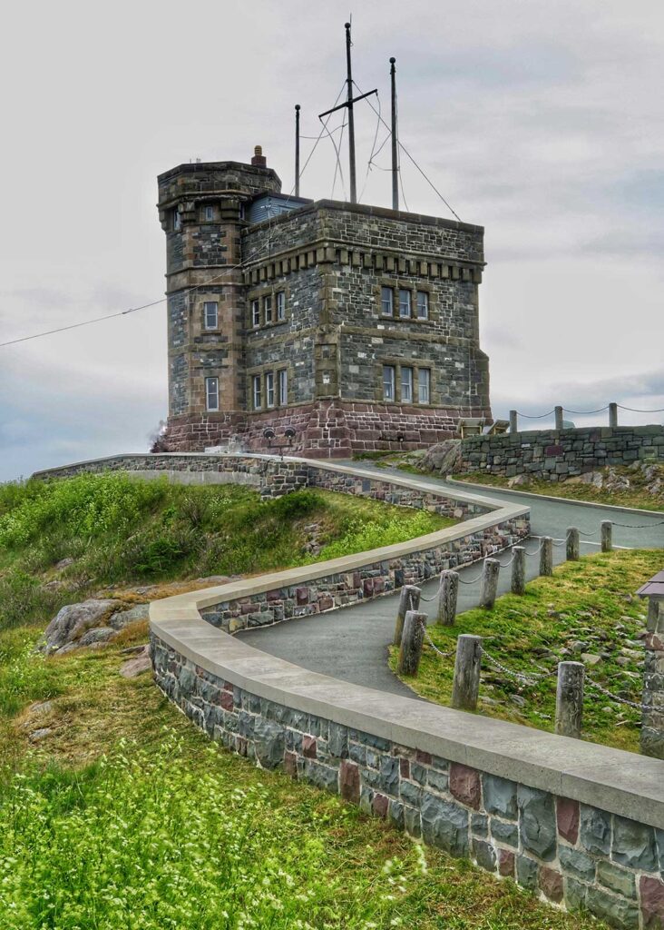
LEFT: After two days travelling eastward from Toronto, Mark arrived on the eastern shores of Newfoundland. No trip to St John’s is complete without visiting Signal Hill National Historic Site, which overlooks The Narrows – the entrance to St. John’s Harbour.
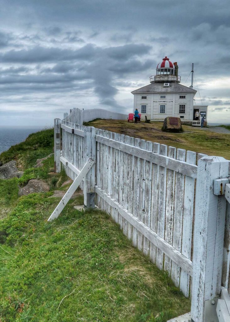
RIGHT: Cape Spear Lighthouse, perched on a hill at the easternmost point in North America, was the perfect place for the 3 Oceans Odyssey to begin – and on no better day than Canada Day.
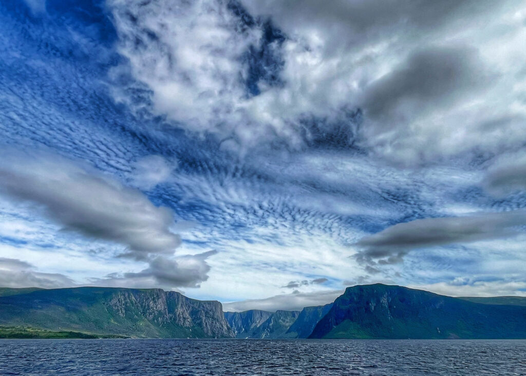
LEFT: A three-day remote-working stopover in Gros Morne National Park was capped off by a boat tour of Western Brook Pond – a glacial-carved 16-kilometre fjord surrounded by billion-year-old cliffs in excess of 2,000 feet high.
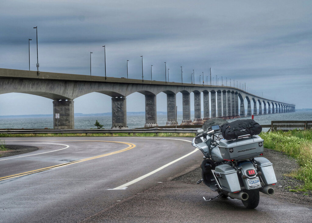
RIGHT: To achieve his goal of riding in all 10 provinces and three territories during the 3 Oceans trip, it was essential to cross the Confederation Bridge – the nearly 13-km long span across the Northumberland Strait that links New Brunswick and Prince Edward Island.
LEFT: Riding to Nunavut is generally considered impossible, since the territory – created from The Northwest Territories in 1999 – has no road access. A little-known detail in the act that established Nunavut gives the territory sovereignty over all of the waters of Hudson Bay and James Bay. That means a bike in the water of James Bay, along the northern Quebec coastline, is officially in Nunavut.
RIGHT: To make a rocky beach crossing possible with large touring bikes, three riding friends joined Mark in Chisasibi, Quebec. The four of them wrestled the bikes into the water for a short “polar dip”. Afterwards, they convoyed south, before Mark split from the group to continue his ride west.
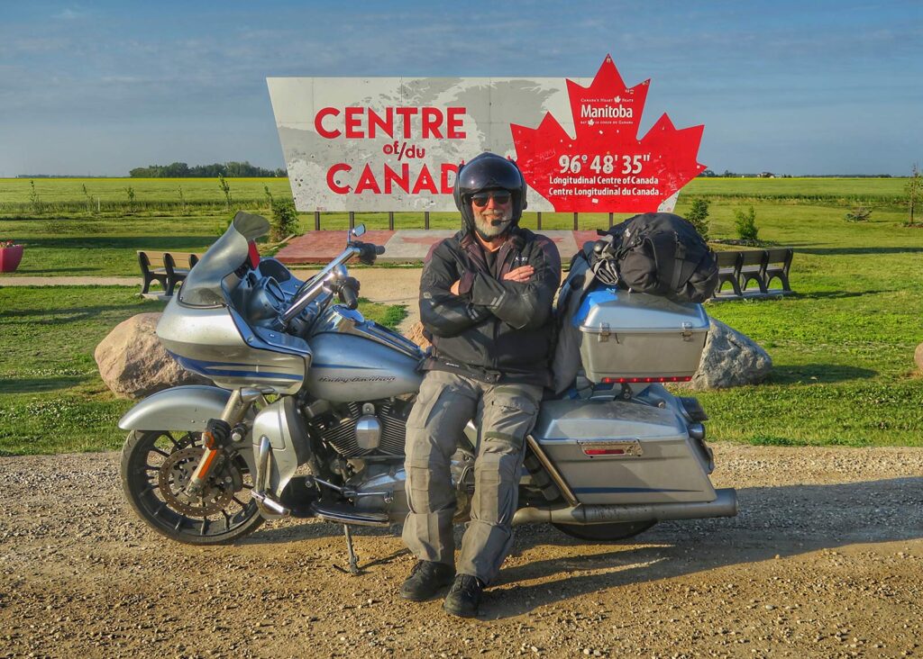
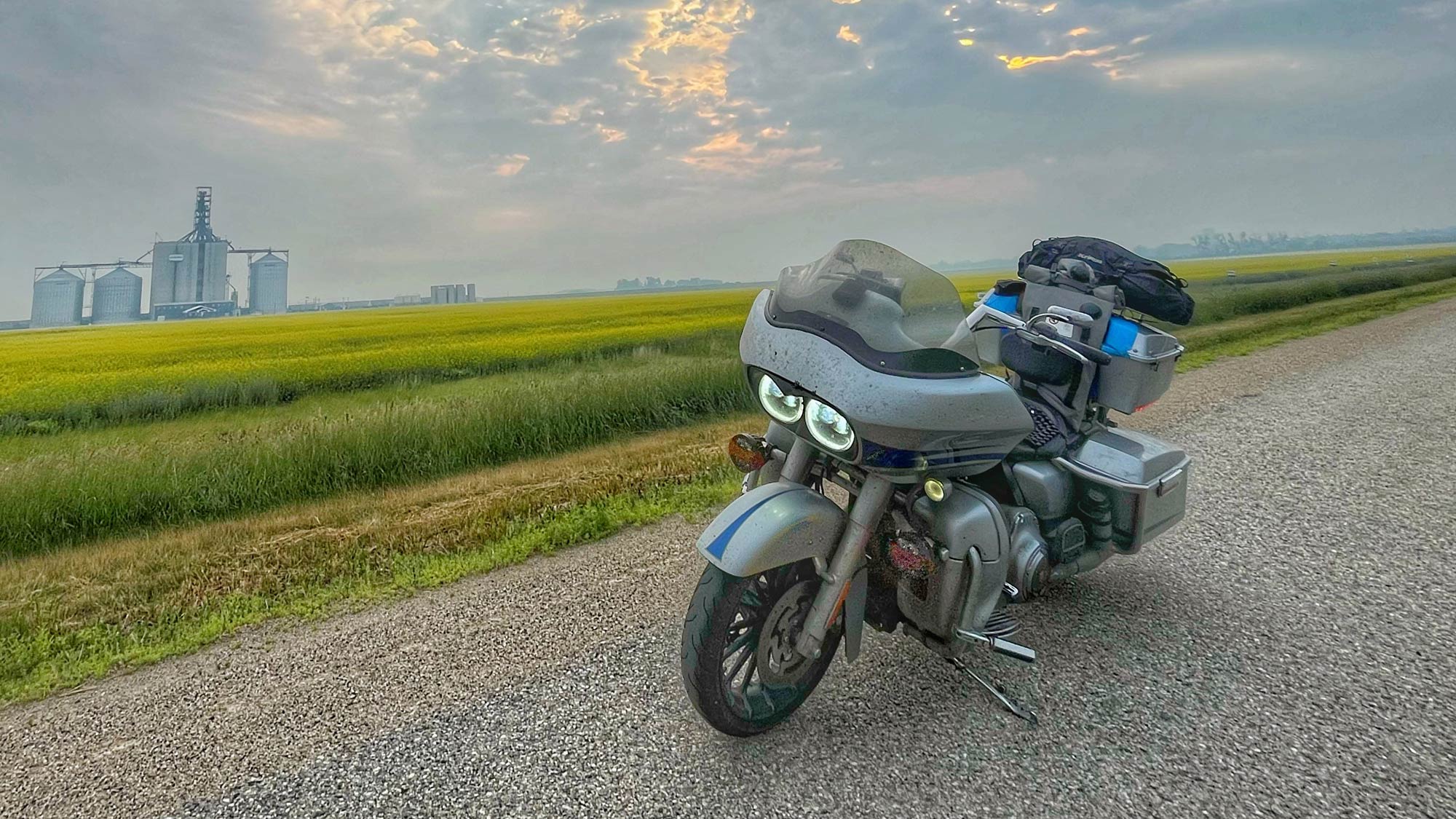
LEFT: Despite having ridden coast to coast many times, Mark still finds it exciting to stop for a photo at the geographic centre of Canada, just east of Winnipeg, Manitoba.
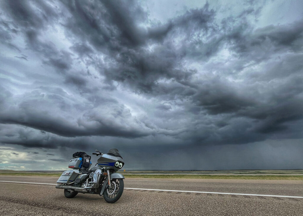
RIGHT: When riding across the Prairies, there’s an unusual beauty to the monotony of the landscape. In such wide-open terrain, you become especially attuned to watching the clouds for signs of trouble.
Into the Arctic: A family convoy north
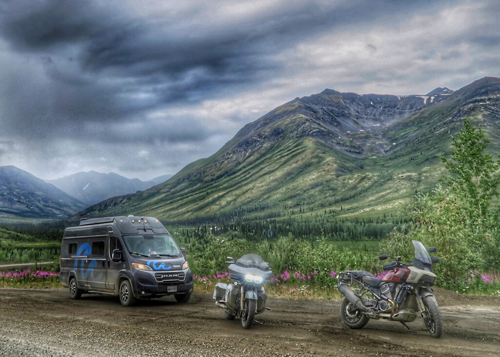
After meeting up with the rest of Mark’s family, the group travelled round trip between Calgary and the shore of the Beaufort Sea at Tuktoyaktuk, Northwest Territories. During this stretch, they travelled as a group, the camper van served both as a mobile home and as storage for the emergency equipment and spare parts needed for the arduous Dempster Highway journey.
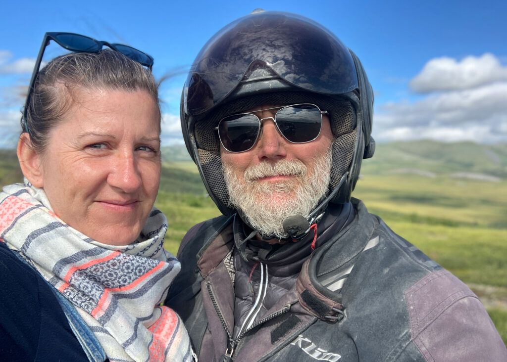
In part two of the trip, the group expanded to include Ian, Mark’s son, on a rental Harley-Davidson® Pan America™, and Hannah, Mark’s partner, and Will, his younger son, in a rental camper van. The three vehicles would travel in convoy for the duration of the round trip between Calgary and the Arctic coast.
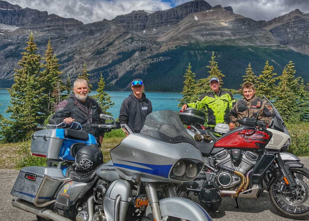
LEFT: The Icefields Parkway, which runs northwest from Banff to Jasper, is a bucket list ride for any self-respecting motorcyclist. Having Murray, Mark’s university-era friend and local rider – as tour guide for the day made the experience even more enjoyable.
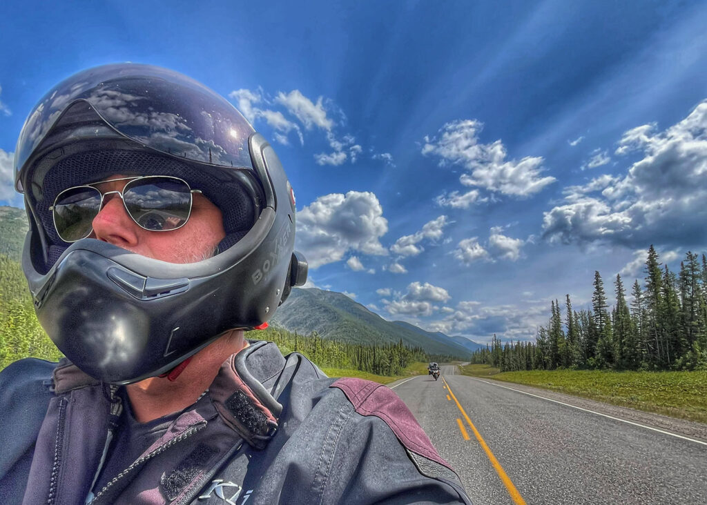
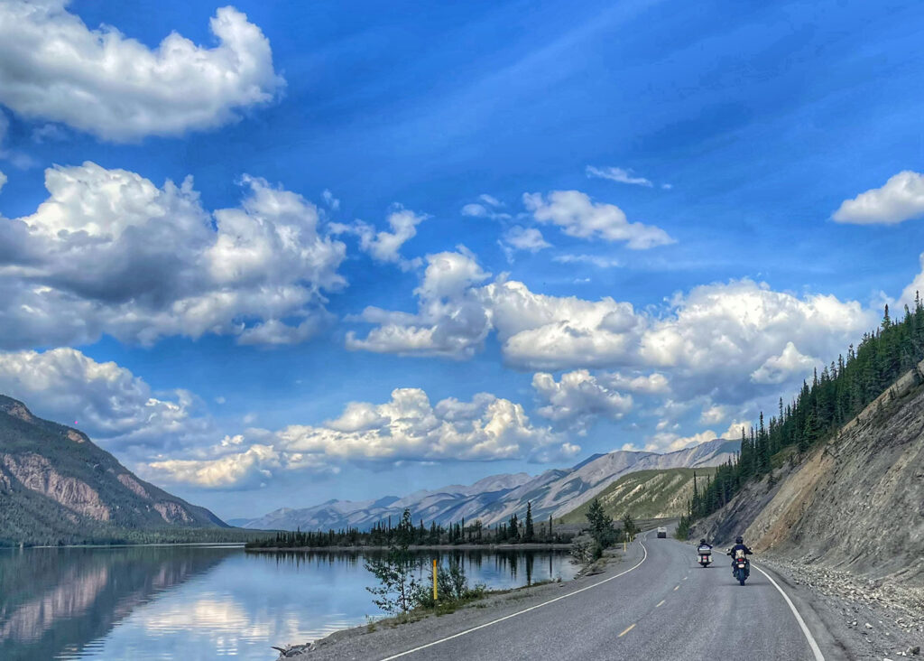
RIGHT: Northern Alberta and British Columbia were all new territory for the group once they passed Edmonton. The effort to go north was well worth it. The route offered beautiful vistas, such as a ride along Muncho Lake on Route 97 between Fort Nelson and the Yukon Border.
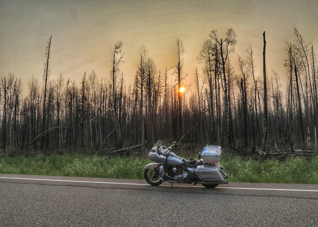
ABOVE: Passing through burnt landscape became a regular occurrence on the ride north to Dawson City, Yukon. The group saw first-hand the aftermath of previous seasons’ wildfires (notably around Jasper), as well as fresh burns from some still smouldering. Their route planning included contingencies for potential fire-related road closures.
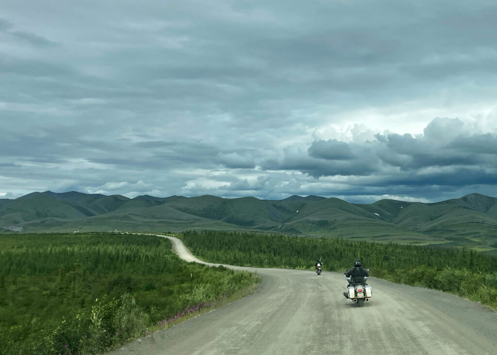
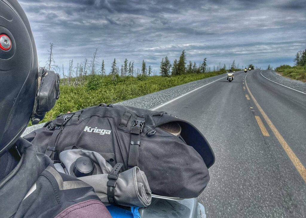
LEFT: Travel was excruciatingly slow along the Dempster, with average speeds of under 50 km/h for the 1,900-kilometre road trip. The challenging road conditions were only partly to blame – the group regularly stopped to take photos as the terrain constantly changed.
RIGHT: There is an ongoing debate about which is better – and more challenging – between the Dempster and the Dalton. After meeting several riders along the route who had ridden both, the consensus seems to be that the Dempster is not only more scenic but also more challenging.
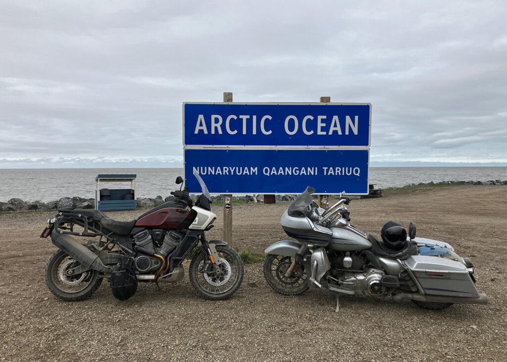
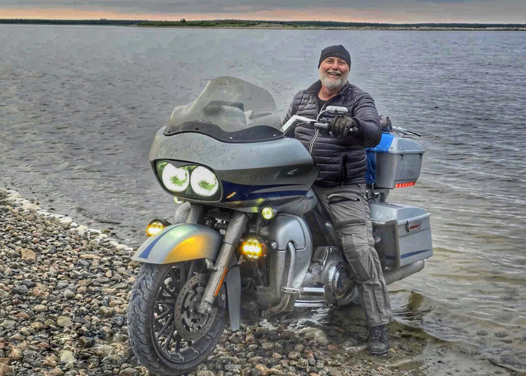
ABOVE: Until 2017, the Dempster Highway ended at Inuvik – a community 150 kilometres short of the Arctic Ocean. For the team, standing on the shores of the Beaufort Sea in the village of Tuktoyaktuk was the ultimate goal – fulfilling a dream first imagined in the mid ’90s by Mark and his father.
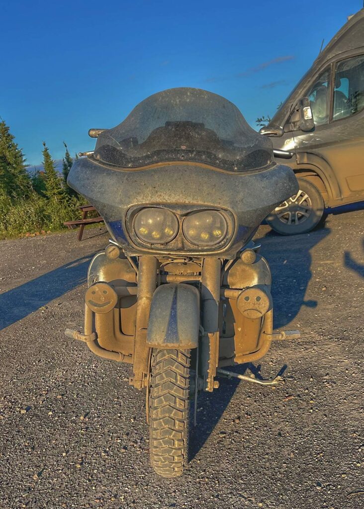
LEFT: The Dempster is brutal on vehicles. Despite one minor laydown by Mark on the first day of gravel, the team was lucky to have suffered no major mechanical issues from either bike, and only one tire puncture on the RV. Cleaning the thick coat of calcium chloride from the vehicles upon return to Dawson City proved arduous and time-consuming.
RIGHT: Following Ian on the gravel-friendly Pan America™, Mark was just as covered in Dempster filth as his bike by end of day. Despite the dirt, the trip remained nothing but pure pleasure.
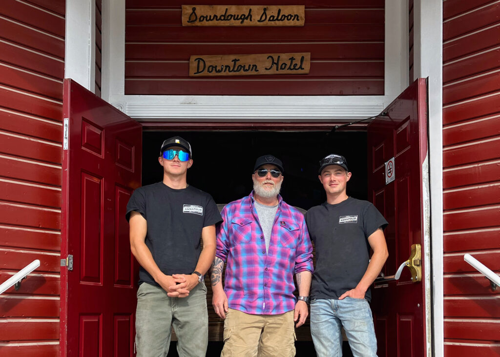
LEFT: There’s no way this trip would have been as meaningful had it not been shared across generations – conceived of by Mark and his father, and carried out by Mark and his sons. That included the required initiation into the infamous Sourtoe Cocktail Club.
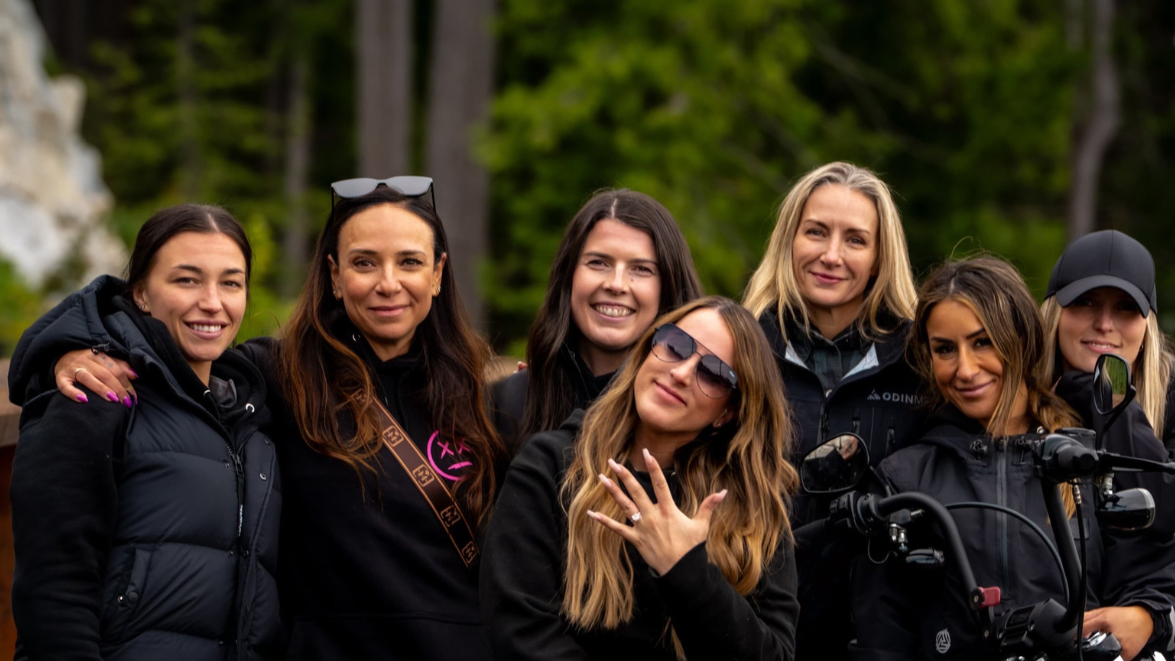
RIGHT: Equally critical to the success of the trip was Hannah, Mark’s partner. Her valour in travelling – and living in close proximity in a cramped campervan – with the three Keating men is worthy of more than a few commendations.
Westward alone, Eastward home
With his family’s departure from Calgary, Mark resumed travelling solo. Over the final 14 days of the trip, Mark would make his way home to Toronto, but only after completing the three-oceans trifecta with a Pacific Ocean stop on the western shore of Vancouver Island at Tofino, B.C.
ABOVE: As he resumed the ride solo, Mark made the most of his time by mixing daytime remote work and rides in the late afternoon and evening. Through this process, he slowly traversed through the mountains to the coast.
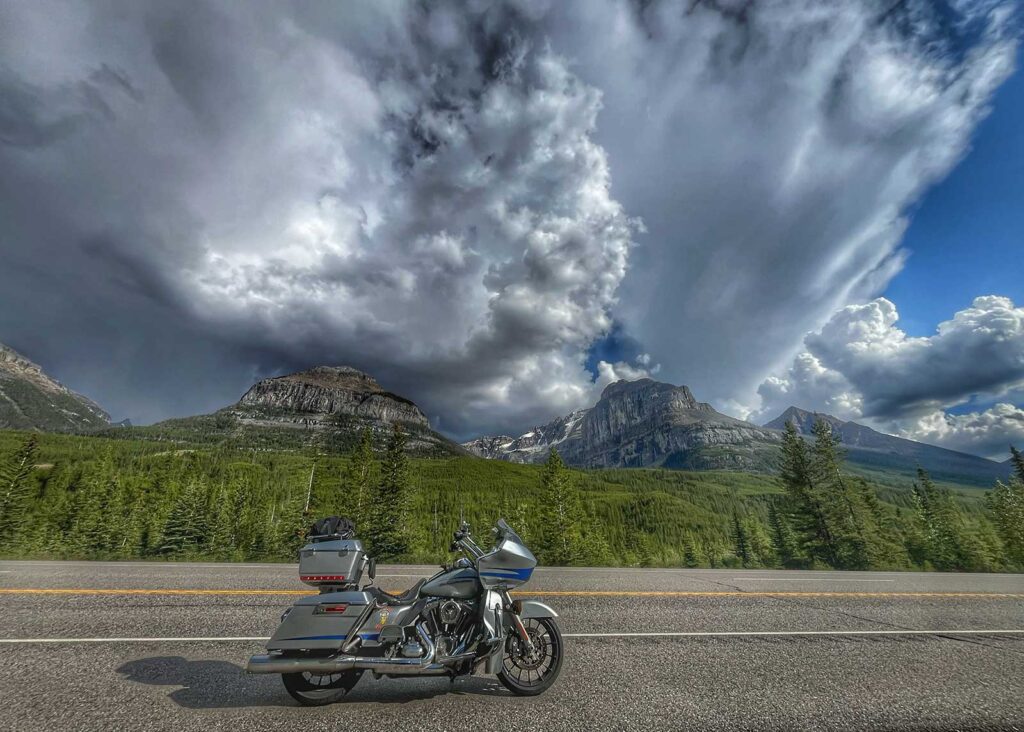
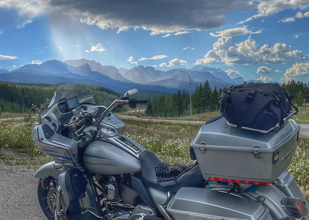
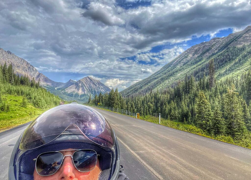
LEFT: Running through the Kananaskis Mountains, Highwood Pass is arguably one of the most scenic drives in Canada. Although only 150 kilometres long, the pass is worth a day trip from Calgary or overnight in Longview, the historic village at its southern end.
RIGHT: It was easy to lose track of time and distance while zigzagging through the southern Rockies. Over the better part of a week, the route passed through five national parks, and over no fewer than six major mountain passes – places deeply embedded into Canada’s Indigenous and immigrant histories.
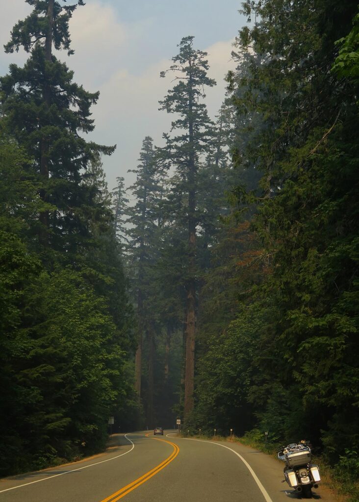
ABOVE: Wildfire issues continued intermittently as Mark travelled west. During his days on Vancouver Island, a wildfire kicked off at Cameron Lake on the access road to Tofino. Smoke drifted for kilometres along the roadway, making the ride through the ancient redwoods of Cathedral Grove even more dramatic.
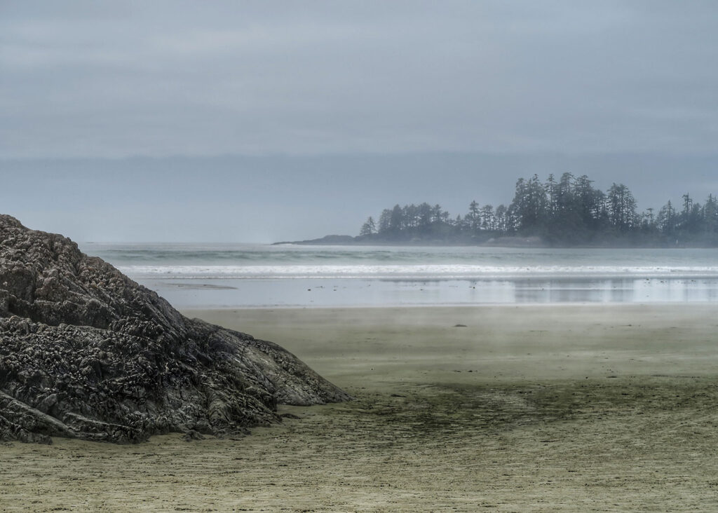
LEFT: Tofino is best known as a luxury surf town on the western shores of Vancouver Island. For Mark, it was his final stop on the Pacific Coast – completing the official 3 Oceans goal he had set out for himself as the foundation of the ride.
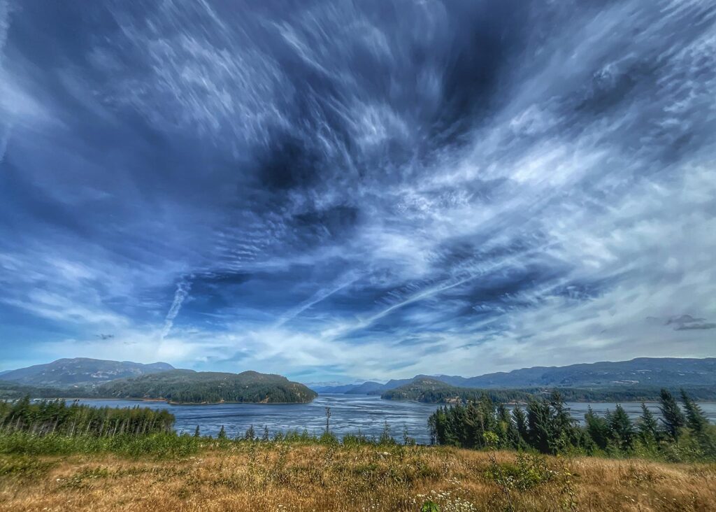
RIGHT: As a long-distance motorcyclist, riding the limited tarmac of Vancouver Island – even for just a few short days – became somewhat repetitive. The highlights were the many stunning views across the Strait of Georgia, which separates the Island from the B.C. mainland.
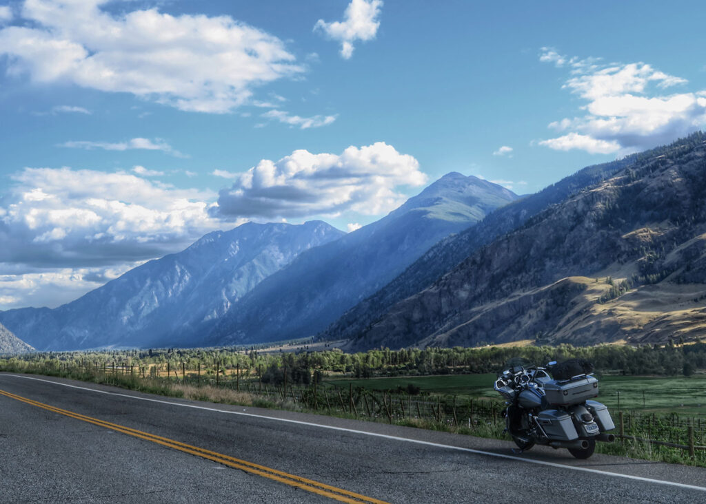
LEFT: Arguably the fastest route east from Vancouver to Toronto follows the Trans-Canada highway northeast through Kamloops and Calgary. A more scenic option is the Crowsnest Highway that hugs the southern boundary of B.C. and Alberta near the U.S. border. This route passes through the stunning Okanagan Valley near Osoyoos.
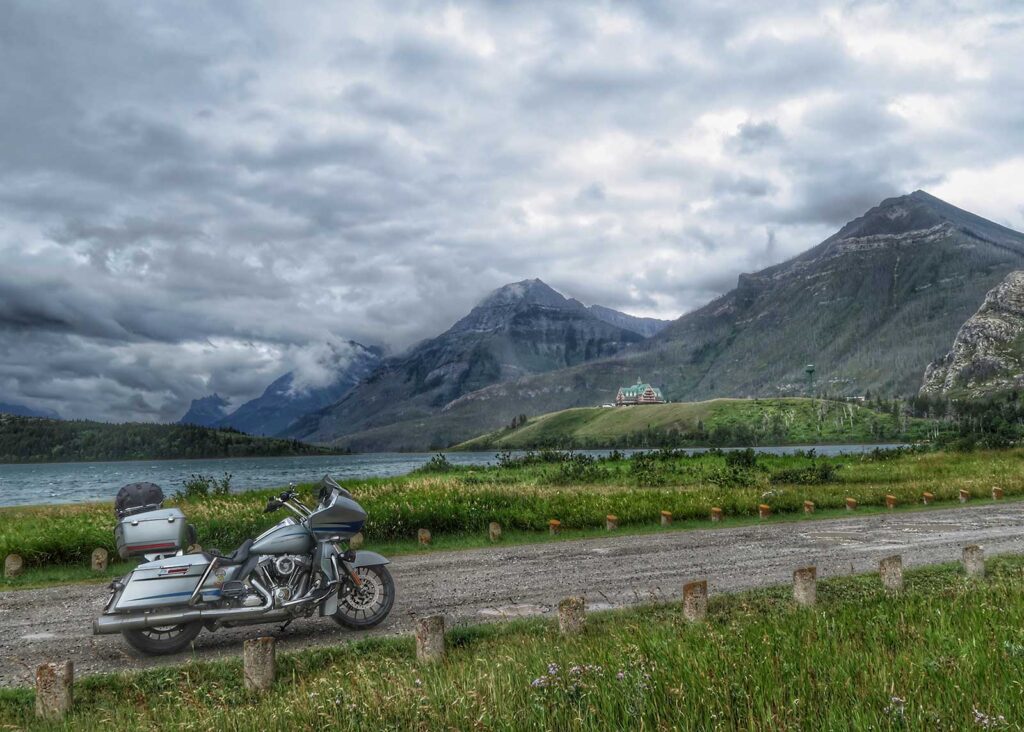
RIGHT: Waterton Lake National Park is located an hour south of the eastern end of the Crowsnest Highway in the foothills of the Rockies. Riders should be alert for Chinook winds, which can appear suddenly and are strong enough to push unsuspecting riders off the road.
A promise kept, a country connected
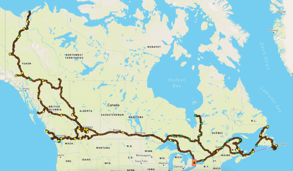
The 3 Oceans ride covered all 10 provinces and three territories, reaching Canada’s Atlantic, Arctic and Pacific coasts. In 45 days, Mark rode more than 30,000 kilometres, and tackled the most challenging section to the Arctic coast together with his family.
Tags:
Read more tales from the Harley Owners Group!
Riding With Purpose
Roxy Vardouniotis’ path into motorcycling reveals how confidence, freedom and belonging are often found on the open road
Destination Challenges: A New Benefit for HOG Canada Members
Lifetime HOG rider sets out to complete all 10 challenges as the program launches nationwide